Online 3D data visualization platform based on webgl, that can load oblique photography, artificial modeling model, BIM and other 3D data Easy-to-use online 3D analysis tool forconvenient Sightline analysis, Viewshed analysis, Shadow analysis, etc.
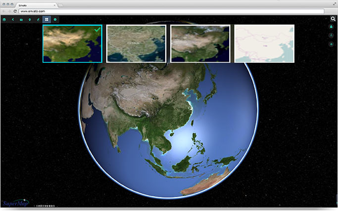
You could overlay online map, Bing Maps, OSM other online maps
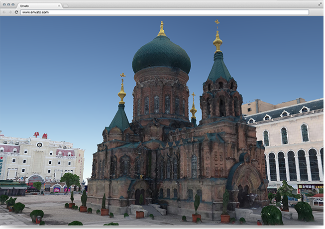
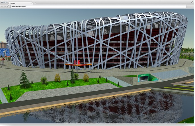
Supports loading of 3D spatial data such as oblique photography and 3D model data
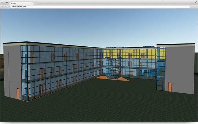
Provides useful functions such as loading BIM data, querying data, and viewing sections
Support dynamic surface feflection effects, and the 3D scene more realistic and beautiful
Online 3D analysis functions, such as convenient singhtline analysis, viewshed analysis, Shadow analysis, etc.
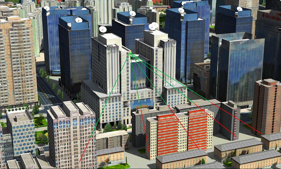
Sightline Analysis
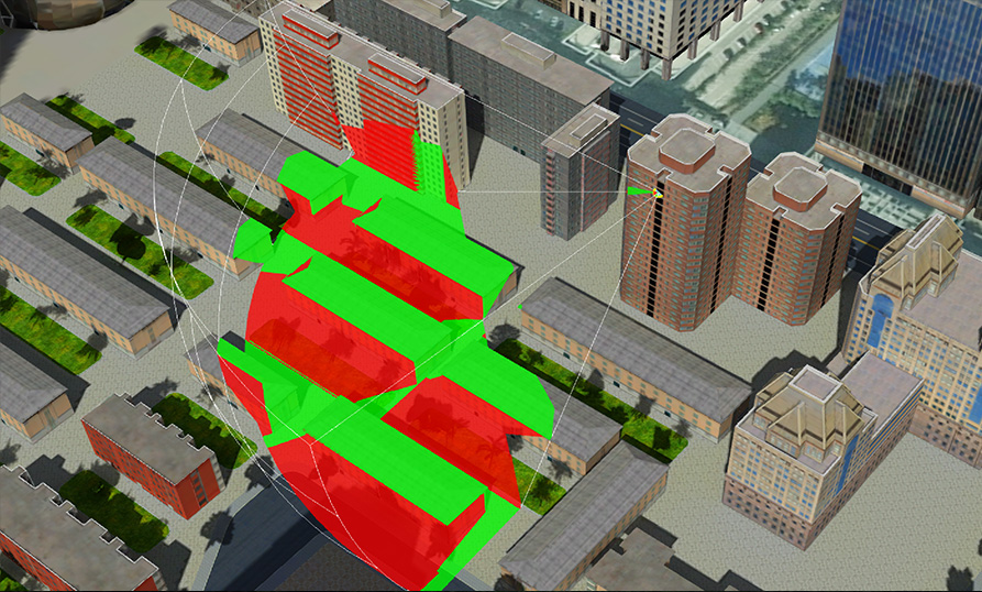
Viewshed Analysis
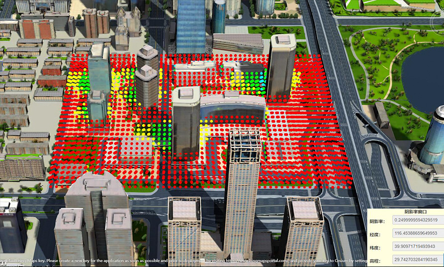
Shadow Analysis
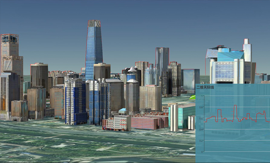
Skyline Analysis
3D Plugin
Export BIM model data from third-party software to SuperMap format (workspace + S3M tile). Your data could be automatically stored online and used online.

SuperMap Exporter for Revit


SuperMap Exporter for MicroStation


SuperMap Exporter for CATIA

SuperMap Exporter for 3ds Max


