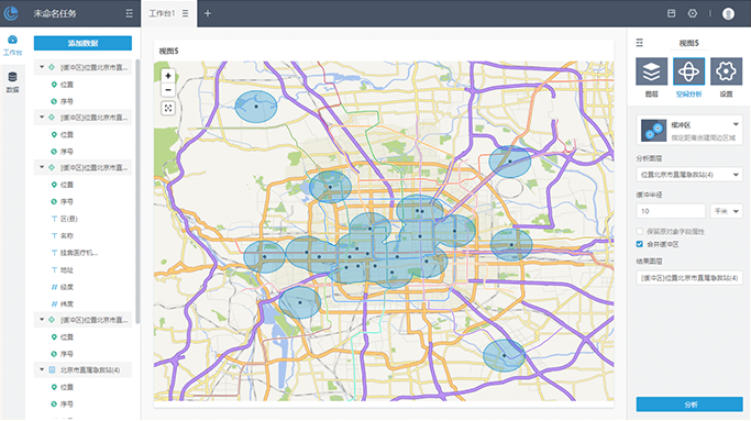
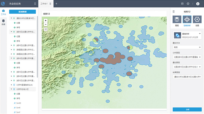
Multiple data sources

Upload your EXCEL or CSV files,
or SuperMap Online data and iServer REST map service.

Chart analysis
Rich chart visualizations,
one-click to generate map and chart,
and customize or preview them all online.
Click for larger image
Spatial Analysis
Using professional spatial analyst tools in brower, no need to build or code any more.
  • Buffer
  • Isonline
  • Isosurface
  • Overlay analysis
  • Thiessen polygon
  • Inverse distance weighted
  • Buffer
    Buffer analyst

    Create buffers based on point, line,
    and area features.

  • Isonline
    Isoline

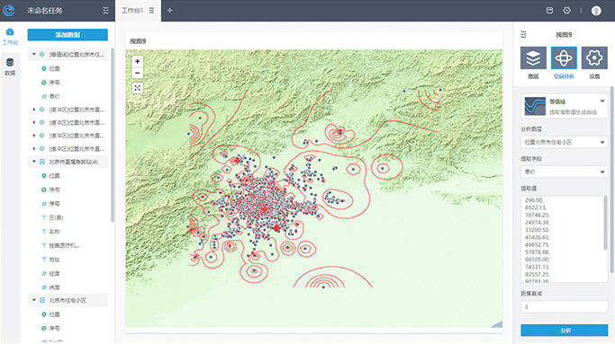
    Extract isolines according to Interpolate a field of point features.

  • Isosurface
    Iso-surface

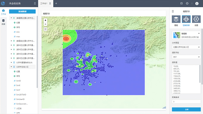
    Extract iso-surface according to Interpolate a field of point features.

  • Overlay analysis
    Overlay analyst

    Overlay analysis of point, line, or area features,such as cropping, erasure, identity, intersection, merge, update.

  • Thiessen polygon
    Voronoi tessellation

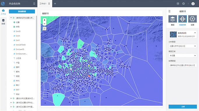
    Create voronoi tessellation polygons based on point features.

  • Inverse distance weighted
    IDW Interpolation

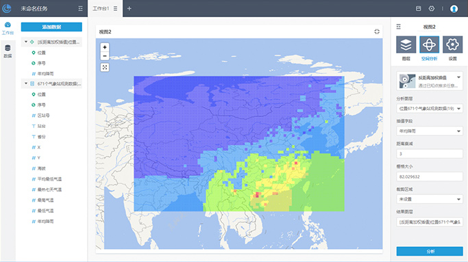
    Generate continuous raster data by interpolate point data, and support setting grid size and area.

Making data online
The Result of your analysis are stored on online,
download or share them to other users and applications to making them more useful.
Scan this QR code to experience GIS data insights result -
[online map] 九寨沟地震分布
[Showcase] Quick visualization of Beijing residential data
Get Started
qq
Contact us
qq
QQ group